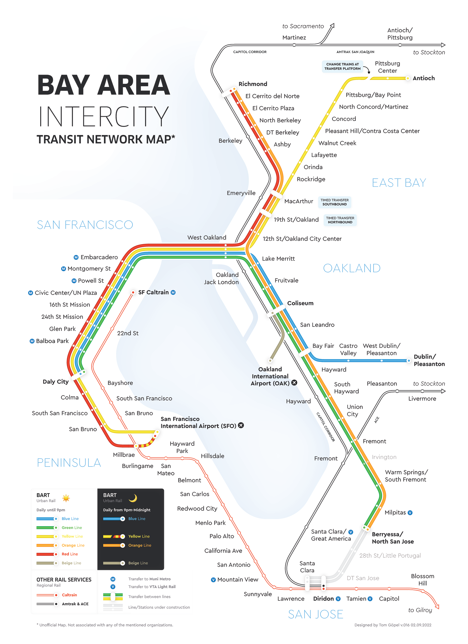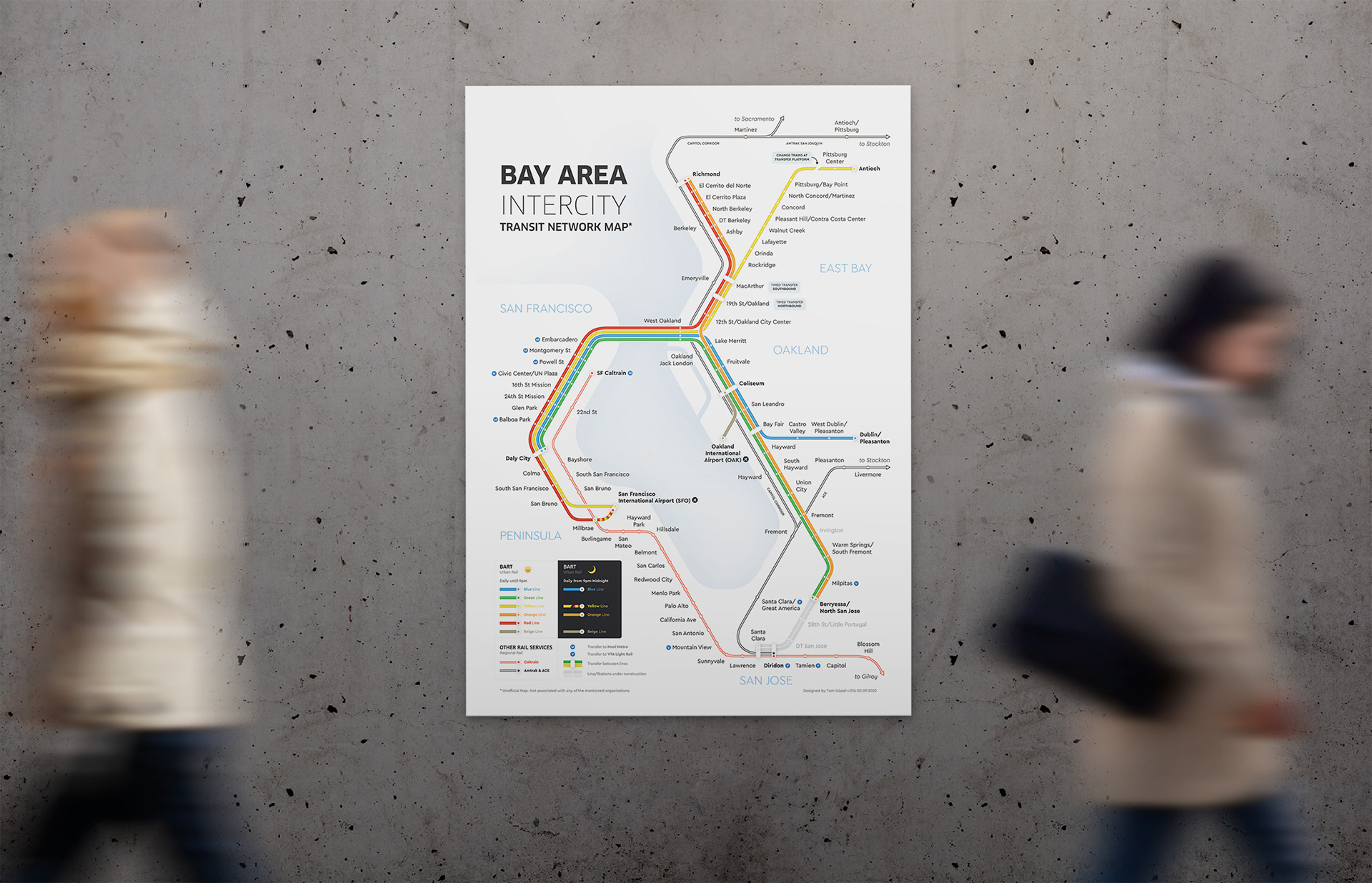
Bay Area Map
The Challenge
Crafting a cohesive network map that seamlessly unifies all rail transportation systems within the Bay Area, ensuring effortless navigation and an optimal transit experience for users.
Tools: Adobe Illustrator
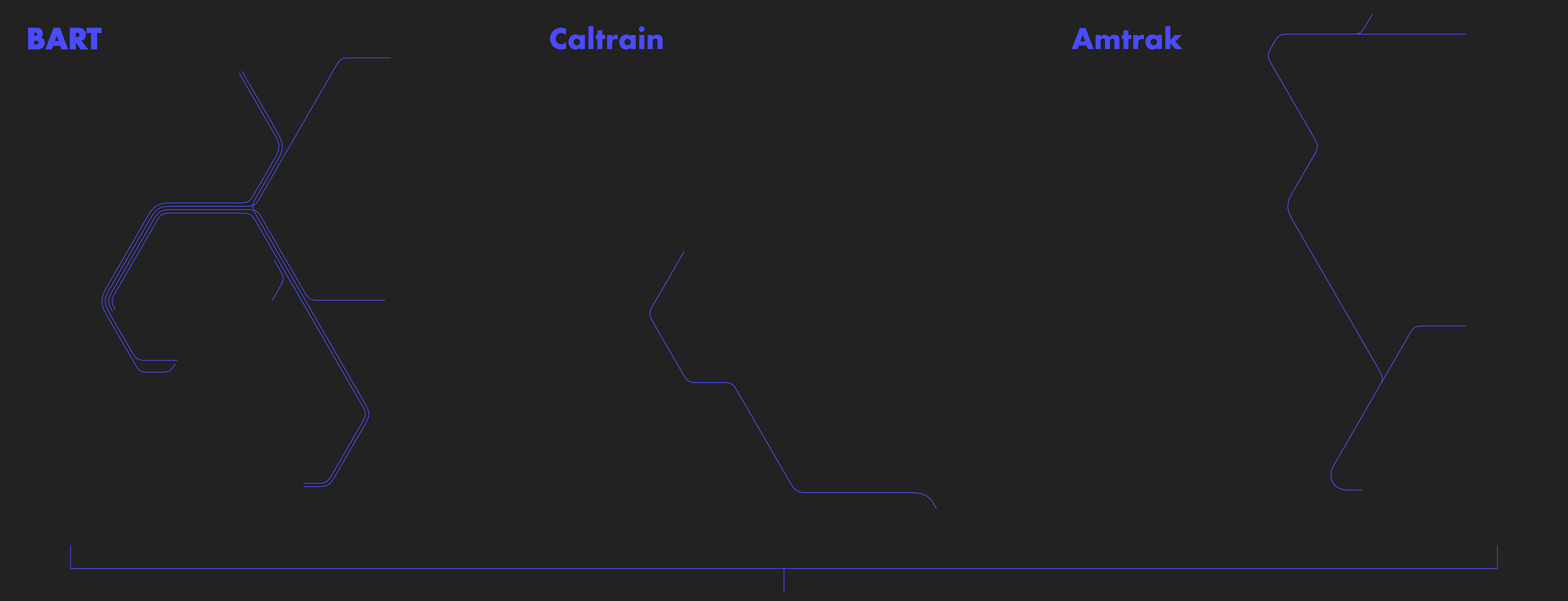
Combined Network

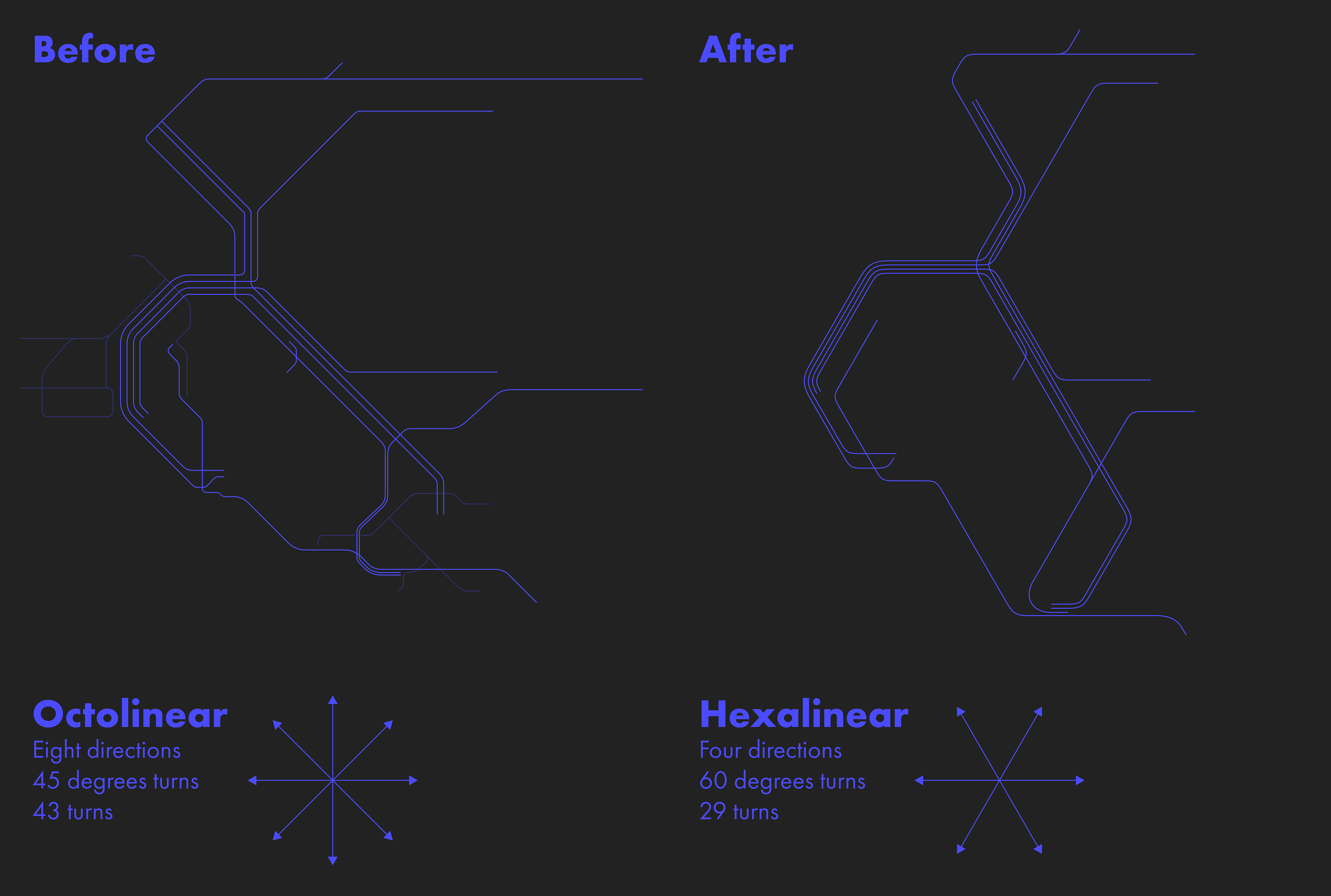
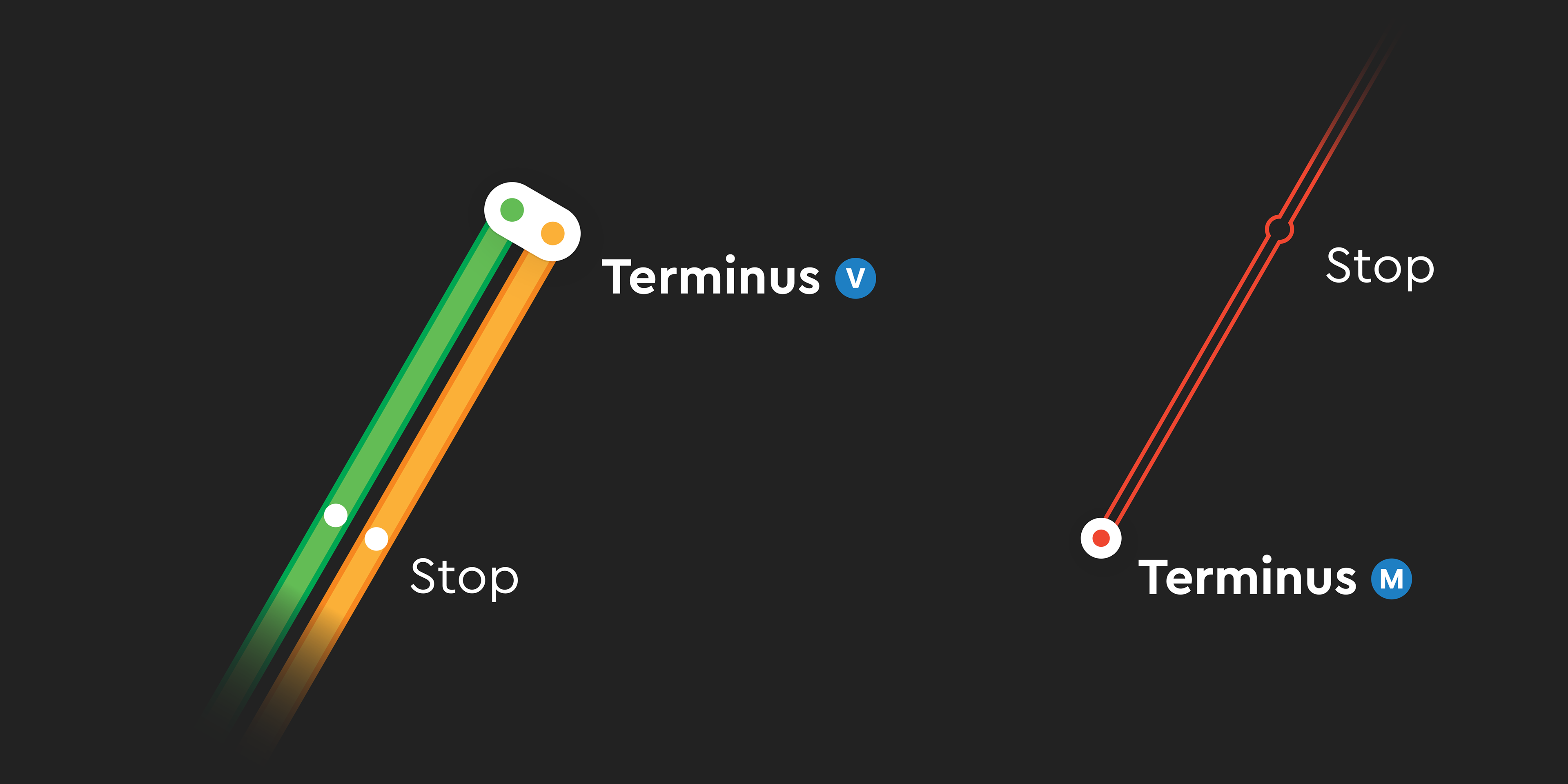
New Geometry
The previous design, with its intricate 45° turns, proved challenging for users to navigate and follow lines effortlessly. The revamped version, boasting a clean and easy-to-read layout, embraces a new geometry with fewer turns, perfectly tailored to the unique geography of the Bay Area. This fresh approach enhances legibility, ensuring a seamless experience for commuters and visitors alike.
Simple Design
The minimalistic approach to station and line design in the new map enhances accessibility and readability for users. San Francisco and San Jose's light rail systems have been made more user-friendly by incorporating intuitive station indicators. By concentrating on the intercity network, this map avoids cluttering the visual space with excessive lines, ensuring a streamlined and focused representation for improved navigation.
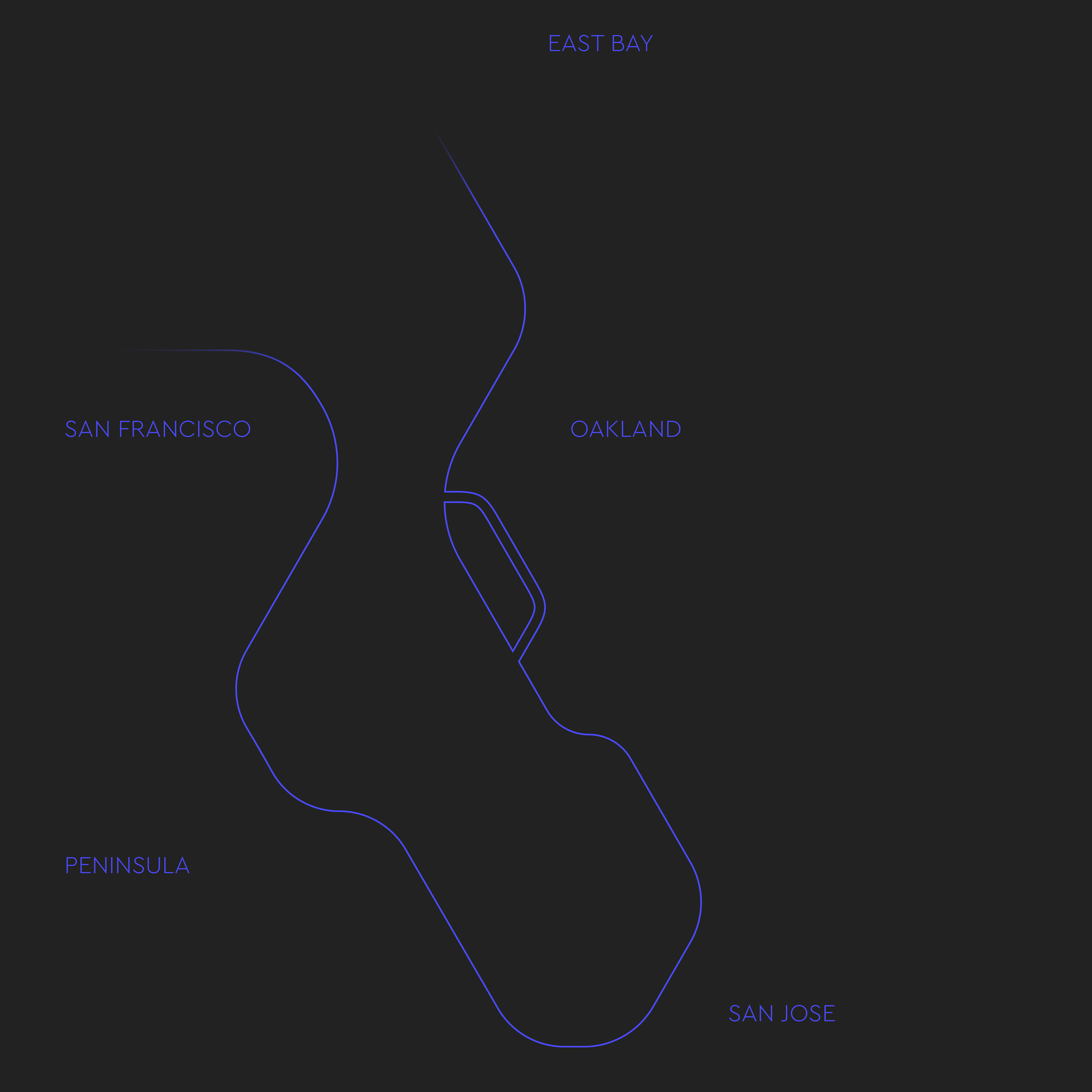
Geography
In the Bay Area, geographic references play a pivotal role in fostering easy orientation. By incorporating these references into the new map, users can effortlessly navigate and situate themselves within the region, resulting in a more intuitive and user-friendly transit experience.
Final Design
The final concept artfully blends minimalistic aesthetics and clean design with an innovative geometry. This fusion enables riders to swiftly grasp the network's layout and effortlessly plan their trips, ensuring a seamless and efficient transit experience.